")
Transforming Infrastructure Planning: Road and Highway Design Using InfraWorks
Designing modern roads and highways is no longer a matter of manual drafts and basic CAD tools. With growing urbanization and increasing traffic demands, engineers require sophisticated tools to visualize, simulate, and optimize road infrastructure. InfraWorks, an advanced design and planning software, has emerged as a game-changer for civil engineers and urban planners. This blog will provide a comprehensive understanding of Road Highway Design InfraWorks, exploring its features, practical applications, and how it enhances efficiency, accuracy, and collaboration in infrastructure projects.
Road Highway Design InfraWorks
Understanding InfraWorks for Road Design
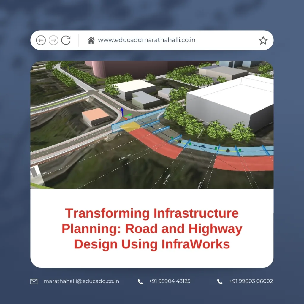
Road Highway Design InfraWorks is a cutting-edge infrastructure design software developed by Autodesk. It allows engineers to create realistic 3D models of roads, highways, and entire urban environments. Unlike traditional CAD software, InfraWorks integrates GIS data, terrain models, and existing infrastructure to produce context-aware designs.
The software enables users to visualize design proposals within actual environments, providing stakeholders with realistic renderings of the final project. By incorporating traffic simulations, slope analysis, and environmental factors, InfraWorks ensures designs are not only structurally sound but also sustainable.
Key features that make InfraWorks ideal for road and highway design include:
-
3D Modeling: Generate highly accurate 3D representations of terrain, roads, and surrounding structures.
-
Design Automation: Use parametric tools to streamline repetitive tasks and maintain consistency.
-
Collaboration Tools: Cloud-based sharing allows multidisciplinary teams to collaborate efficiently.
-
Scenario Analysis: Simulate multiple design options and compare their performance.
By leveraging these features, civil engineers can reduce design errors, save time, and produce cost-effective road and highway projects.
Integrating Terrain and Environmental Analysis
A critical step in road and highway design is understanding the terrain and environmental impact of the project. InfraWorks excels in integrating GIS data, topographical surveys, and satellite imagery, allowing engineers to make informed decisions from the early stages of planning.
Terrain Modeling
InfraWorks automatically converts terrain data into a dynamic 3D model. Engineers can visualize slopes, cut-and-fill requirements, and drainage paths. These insights are crucial for designing roads that minimize environmental disruption and construction challenges.
Environmental Considerations
With InfraWorks, it’s possible to analyze environmental factors such as flood zones, vegetation, and soil stability. The software allows engineers to optimize alignments to reduce ecological impact while maintaining safety and efficiency.
By combining terrain analysis with environmental assessments, InfraWorks ensures that the designed road or highway aligns with both engineering standards and sustainability goals.
Designing Roads and Highways Step by Step
The process of designing roads and highways in InfraWorks follows a systematic approach, ensuring accuracy and efficiency.
Alignment Creation
The first step is defining the road’s horizontal and vertical alignment. InfraWorks allows engineers to create flexible alignments with parameters such as curve radii, lane widths, and design speeds. Transition curves, intersections, and roundabouts can also be modeled with precision.
Corridor Modeling
Once alignments are defined, corridor modeling generates the road geometry, including lanes, shoulders, medians, and embankments. InfraWorks automatically calculates earthwork volumes, reducing the risk of misestimating material requirements.
Traffic and Safety Analysis
InfraWorks integrates traffic simulation tools that allow engineers to evaluate how vehicles will interact with the proposed road. Lane merging, turning radii, and sight distances are analyzed to ensure safety standards are met.
Visualizing the Project
High-quality renderings of the road in its actual environment help stakeholders understand the design intent. InfraWorks provides real-time walkthroughs, aerial perspectives, and 3D visualizations, making presentations more effective.
By following these steps, engineers can develop precise and reliable road designs that minimize revisions during construction.
Collaborative Workflow for Project Efficiency
One of the most significant advantages of InfraWorks is its collaborative workflow. Modern infrastructure projects often involve multiple stakeholders, including engineers, urban planners, government authorities, and contractors. InfraWorks simplifies collaboration by allowing:
-
Cloud-Based Data Sharing: Teams can access the latest design model in real-time, reducing errors due to outdated files.
-
Interdisciplinary Coordination: Civil, structural, and environmental engineers can work simultaneously on the same model.
-
Stakeholder Engagement: Realistic visualizations help non-technical stakeholders understand complex engineering decisions, improving approval processes.
This collaborative environment accelerates project timelines and ensures that all parties are aligned from the conceptual stage to final implementation.
Optimizing Design with Simulation and Analysis
InfraWorks goes beyond 3D modeling by offering robust simulation and analysis tools. These tools help engineers optimize road and highway designs to meet performance, cost, and safety goals.
Traffic Flow Simulation
By simulating traffic patterns, engineers can identify congestion points, optimize lane configurations, and plan efficient intersections. This ensures the road will handle projected traffic volumes while minimizing delays.
Structural Analysis
InfraWorks integrates with other Autodesk tools, allowing engineers to perform structural analysis for bridges, overpasses, and retaining walls. Early identification of structural concerns reduces the risk of costly revisions.
Environmental Impact Assessment
Simulations for water runoff, erosion, and noise help engineers design roads that comply with environmental regulations. InfraWorks provides actionable insights for sustainable and resilient infrastructure projects.
By leveraging these simulation capabilities, engineers can create roads and highways that are safe, efficient, and environmentally responsible.
Conclusion: Advancing Infrastructure with InfraWorks
Road Highway Design InfraWorks has evolved significantly with the adoption of this tools. Engineers can now integrate terrain data, environmental analysis, and traffic simulations into a single platform. The software enhances collaboration, reduces errors, and accelerates project delivery.
Using InfraWorks for road and highway design empowers engineers to create infrastructure that is precise, sustainable, and future-ready. Whether for urban highways, rural roads, or complex intersections, InfraWorks provides the tools necessary to turn conceptual ideas into practical, real-world solutions.
Investing in InfraWorks expertise not only improves project outcomes but also positions engineering professionals at the forefront of modern infrastructure planning.

